7 Crucial Insights: How Drone Radar Is Revolutionizing Mars Water Exploration
In the quest to unlock Mars’ ancient secrets, scientists are turning to a surprising Earth-based tool: drone-mounted radar. Recent tests over glaciers in Norway and Iceland have shown that this technology can map buried ice with astonishing precision, providing a blueprint for future Mars missions. By understanding where subsurface water ice lies, spacecraft could drill with pinpoint accuracy, saving time and resources. This listicle explores seven key insights from this breakthrough, connecting Earth’s icy landscapes to the red planet’s hidden reservoirs.
1. The Core Technology: What Is Drone Radar?
At its heart, drone radar uses ground-penetrating radar (GPR) mounted on unmanned aerial vehicles. These systems emit radio waves that bounce off subsurface layers, revealing buried ice, rock, or sediment. Unlike satellite-mounted radar, drones fly at low altitudes, capturing high-resolution data over specific areas. The technology is light, agile, and can navigate rugged terrain—ideal for Mars-like environments. Importantly, drone GPR can differentiate between ice and rock by analyzing signal reflections, offering a non-invasive way to map water reserves up to 100 meters deep.

2. Why Mapping Subsurface Ice Matters for Mars
Water is the linchpin for sustained human exploration of Mars. From life support to rocket fuel, in situ water extraction could cut mission costs by billions. But not all ice is easy to access: it may lie under thick dust or be mixed with permafrost. Drone radar provides a three-dimensional view of ice deposits, helping mission planners select sites where drilling is feasible. Without such maps, rovers might spend months probing dry ground, wasting energy and time. This technology promises to turn guesswork into a data-driven strategy.
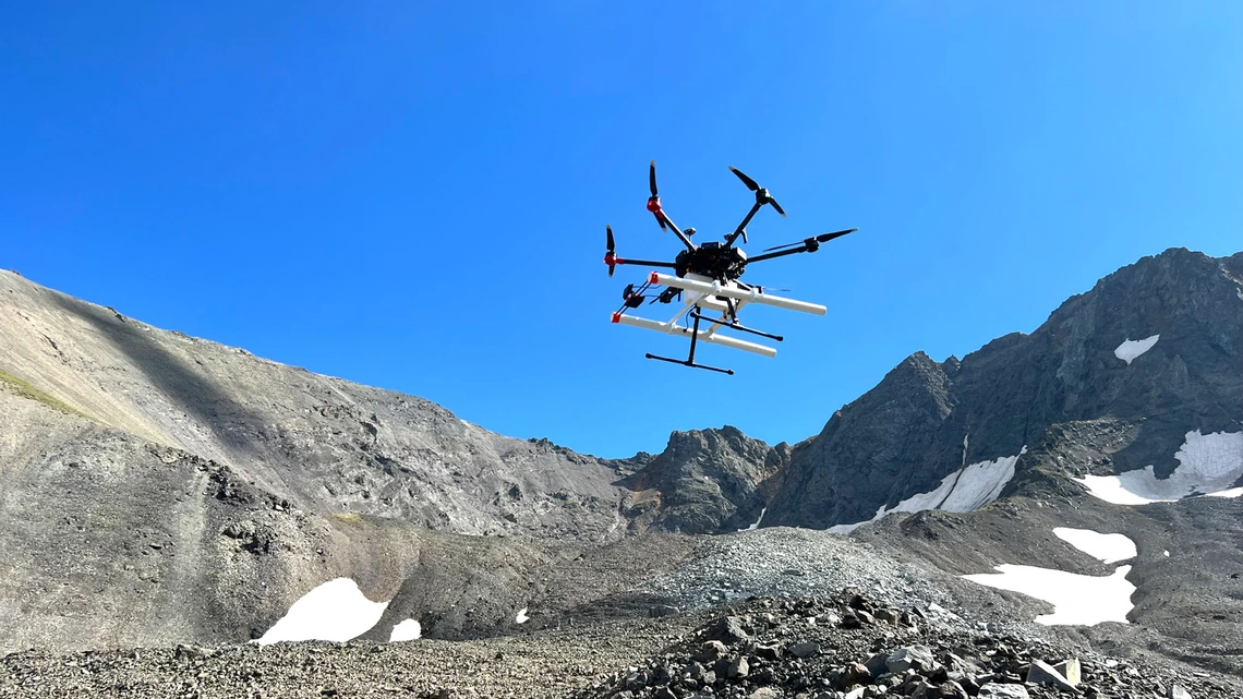
3. Earth’s Glaciers as Perfect Testbeds
To prove the concept, researchers flew drone-mounted radar over Earth’s glaciers—specifically in Svalbard, Norway, and Iceland. These locations mimic Martian conditions: cold, dry, and with layered ice buried under debris. The results were stunning: the drone detected buried ice ridges and slabs with resolution down to a few meters. One test mapped a 50-meter-thick ice body hidden beneath volcanic ash, exactly the kind of feature expected on Mars. The successful tests validate the technology’s readiness for off-world deployment.
4. How the Data Guides Drilling Decisions
Once a drone radar survey is complete, the data is processed into 3D models of subsurface structures. These models show where ice is thickest, its depth, and its purity. Engineers can then calculate the optimal drilling path—avoiding rock obstacles and maximizing yield. For Mars, this means a spacecraft could arrive with a pre-selected drill site, bypassing the need for lengthy reconnaissance. The drone radar acts as a treasure map, reducing uncertainty from months to days.
5. Comparing Earth and Martian Conditions
While Earth’s glaciers are useful analogs, Mars presents tougher challenges. The Martian atmosphere is thinner, temperatures are colder, and surface dust can absorb radar signals. However, drone radar’s low-frequency bands (50–500 MHz) are designed to penetrate dry dust layers up to 10 meters thick. Tests in Earth’s cold deserts—like the Antarctic Dry Valleys—have already demonstrated the same signal penetration needed for Mars. The key difference: Martian gravity is lower, affecting drone flight dynamics, but engineers are already adapting autopilot algorithms to compensate.
6. The Implications for Future Human Missions
Human crews will need a reliable water supply. A single drone radar survey could pinpoint multiple ice deposits near a planned habitat, allowing for redundant water sources. Beyond drinking, water can be split into hydrogen and oxygen for fuel and breathable air. Furthermore, ice can shield habitats from radiation. The technology supports NASA’s “follow the water” strategy, directly enabling the Artemis-Mars synergy. The same drone system could even be used for maintenance checks, scanning for shifting ice layers over time.
7. Next Steps and Challenges Ahead
Before landing on Mars, drone radar must undergo rigorous testing in vacuum chambers and low-atmosphere flights. Miniaturization is a priority: today’s Earth drones weigh 15–20 kg, but a Mars version would need to be under 5 kg to fly in the thin atmosphere. Power generation via solar panels is another hurdle. However, researchers are optimistic. Plans include a demonstration aboard a Mars helicopter-like platform within a decade. The ultimate goal is a fully autonomous drone-survey mission, mapping Martian ice and returning home to guide the drill.
In conclusion, drone-mounted radar is more than a clever hack—it’s a strategic steppingstone to sustainable Mars exploration. By combining Earth-based tests with visionary engineering, scientists are turning a science fiction dream into a practical tool. The next time we see a tiny drone buzzing over a glacier, remember: it might be rehearsing for the red planet.